• Blog
  • Site Contents
  • Photo Galleries
  • MUSIC
  • ABOUT/CONTACT
Menu

Mark Johnston

  • Blog
  • Site Contents
  • Photo Galleries
  • MUSIC
  • ABOUT/CONTACT

Devil's Garden, Arches National Park

​A few images from a hike in Devil's Garden in Arches National Park near Moab, Utah.

Park Avenue
Park Avenue

​Large fins of rock in Arches National Park.

1221-_P2A-4313.jpg
1221-_P2A-4322.jpg
1221-_P2A-4329.jpg
1221-_P2A-4338.jpg
1221-_P2A-4364.jpg
1221-_P2A-4389.jpg
Landscape Arch
Landscape Arch

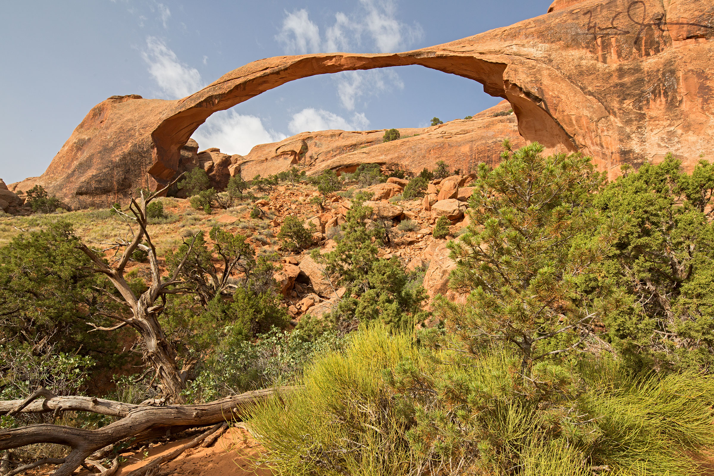
Landscape Arch is the longest natural arch in the world, the span having been measured in 2004 at 290.1 ± 0.8 feet (88.4 m).

Since 1991, three slabs measuring 30, 47, and 70 feet (9.1, 14, and 21 m) long have fallen from the thinnest section of the arch, and the section of trail that once passed beneath it has been closed by the Park Service in the interest of safety.

1221-_P2A-4407.jpg
1221-_P2A-4402.jpg
1221-_P2A-4453.jpg
Double O Arch
Double O Arch

​Double O Arch is the second largest arch within the Devils Garden area, with only Landscape Arch having a longer span.

The large upper arch has a span of 71 feet, and the lower arch has a 21-foot span.

1221-_P2A-4522.jpg
1221-_P2A-4540.jpg
1221-_P2A-4546-4560.jpg
1221-_P2A-4572.jpg
1221-_P2A-4579.jpg
1221-_P2A-4580.jpg
1221-_P2A-4583.jpg
1221-_P2A-4588.jpg

Izu Oshima

Izu Oshima [伊豆大島] is the largest of the seven islands in Japan's Izu Archipelago that stretches from just off the east coast of the Izu Peninsula southward about 250 km.

The islands are of volcanic origin.  Izu Oshima experienced its most recent eruption in 1986, with significant lava flows rolling down from the Mihara summit.

Mihara crater from near the 山頭口 bus stop

Mount Mihara, with its flanks striped by lava flows from the 1986 eruption.

Map of the Mihara crater area

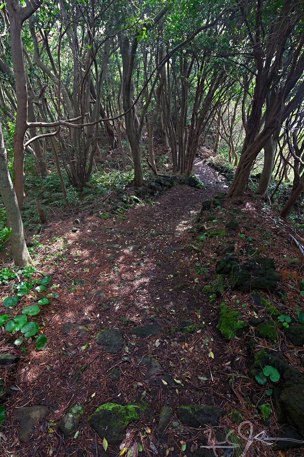
​We start our journey from the south, at the point marked 現在地.

From there, we are walking north along the purple route, the west along a short section of the rim to the red route, and the west and south to the hotel, labeled 大島温泉ホテル.

1115-5D-9636.jpg
1115-5D-9674-9675.jpg
1115-5D-9653+9655.jpg
1115-5D-9645.jpg
1115-5D-9700.jpg
1115-5D-0009-0010.jpg
1115-5D-0018.jpg
1115-5D-0048.jpg
The last half kilometer to the hotel

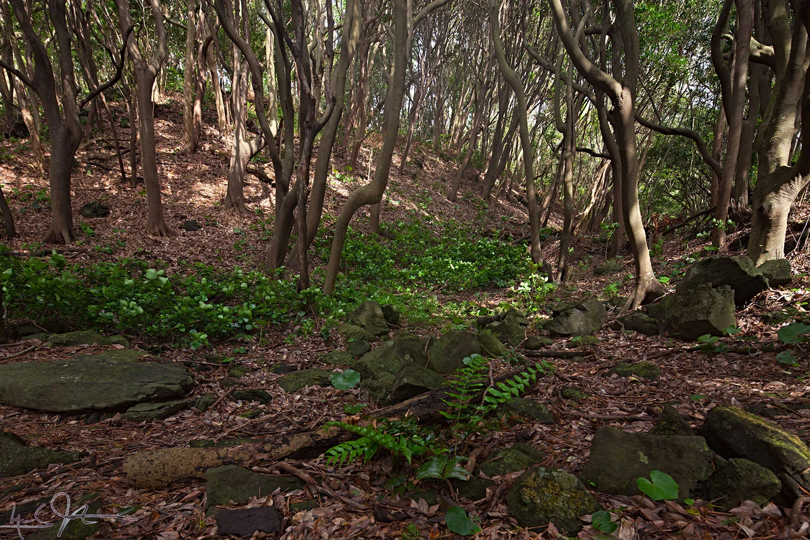
​The last several hundred meters to the Oshima Onsen Hotel are along a track through a thicket of trees, a welcome change from the black cinders cloaking the mountain sides.

1115-5D-0076.jpg
1115-5D-0079-0080.jpg
1115-5D-9641.jpg
1115-5D-9691.jpg
1115-5D-9713.jpg
三原神社 Mihara Shrine
三原神社 Mihara Shrine

​Mihara Shrine lies on the edge of the outer crater.

1115-5D-9734-9735.jpg
1116-5D-0135-157.jpg
1116-5D-0162.jpg
1116-5D-0163.jpg
1116-5D-0164.jpg
1116-5D-0167.jpg
1116-5D-0180.jpg
1116-5D-0186.jpg
1116-5D-0194.jpg
1116-5D-0232.jpg
1116-5D-0237.jpg
1116-5D-0275.jpg
1116-5D-0310-0311.jpg
1116-5D-0313-0314.jpg
1116-5D-0323.jpg
1116-5D-0334-0335.jpg
1116-5D-0372-0373.jpg
Trees in bloom on Oshima.

​The verdancy and color of trees in bloom contrasts with the black ejecta cloaking the flanks of Mount Mihara.

Jyogasaki Coast

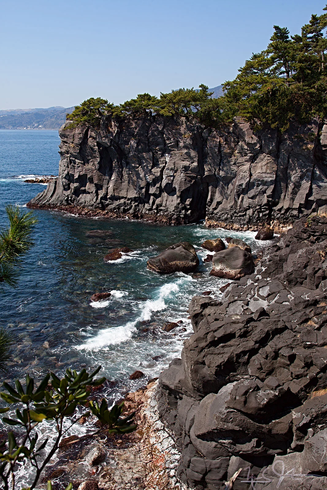
​Along the eastern coast of Japan's Izu Peninsula, about 60 km southwest of Tokyo, lies the Jyogasaki Coast, named because its steep, rocky cliffs look like the curved walls surrounding Japanese castles.

I hiked along this coast many times during the 6 years I lived in Ito, one of the larger towns on the peninsula.​

Jyogasaki Kaigan station - 城ヶ崎海岸駅

​This station is one of the gateway stations to the coast.  It is about 40 minutes south from Atami Station on the Izu Kyu line that runs along the eastern coast of the Izu Peninsula all the way down to Shimoda at the peninsula's southern tip.

​

From this station, it's about a 20-minute walk downhill to the coast.​

1027-5D-6250.jpg
1114-5D-6984.jpg
1014-5D-1810.jpg
Renchakiji Temple
Renchakiji Temple

​This temple sits right on the coast.  Since I usually started my hikes a few kilometres further south, this was often the endpoint of my hike, with cold tea in the summer or amazake [warm, sweet sake] served in the winter.

Nichiren, founder of the Buddhist sect that bears his name, was exiled in this area by the Kamakura Bakufu [Shogunate], in the year 1261, for refusing to stop preaching what many in power considered his revisionist version of Buddhism.​

1114-5D-7055.jpg
1114-5D-7058.jpg
1114-5D-7067.jpg
1114-5D-7071.jpg
1027-5D-6240.jpg
1114-5D-7080.jpg
1114-5D-7085.jpg
1114-5D-7105.jpg
1114-5D-7156.jpg
1114-5D-7022.jpg
1114-5D-7202.jpg
1027-5D-6235.jpg
Yama momo - "mountain peach"

A plaque placed at the base of this venerable tree reads:​

ヤマモモは、本州中部外南の温暖な地方に生育する常緑高木です。ここ城ヶ崎は伊豆随一の郡生地として知られ、この付近の古老たちはやんもと呼んでいます。

ヤマモモの木は、雌雄異株で、雄木の花粉は春風(4月頃)に乗って、遠くは数キロメートルも離れた雄花と交配します。その果実は直径1〜2cmの球状の堅い種子を苺状をした果肉で包み、熟すと暗紅紫色となります。

この頃が最も美味しく、その甘酸っぱい味と独特の香りは、初夏の城ヶ崎海岸の風物詩として親しまれています。

静岡県 伊東市

​

Yama mono [Japanese Bayberry, Myrica rubra] is an evergreen tree growing in the temperate region of south central Honshu [the main island of Japan].  Among the elders of this area, the Jyogasaki Coast is said to be the true fabric of the Izu Peninsula.

The yama momo tree has separate male and female plants.  The male pollen rides the spring breezes in April and can pollinate female flowers several kilometers away.  

The fruit is spherical, with a diameter of 1 to 2 cm, and dark red to purple when ripe, and its most delicious, sweet-sour taste and distinctive aroma has been popular as a true symbol of early summer along the Jyogasaki Coast.

Ito, Shizuoka Prefecture

​

1114-5D-7218.jpg
1114-5D-7225.jpg
1114-5D-7229.jpg
1114-5D-7231.jpg
1027-5D-6233.jpg
1027-5D-6243.jpg
1027-5D-6254.jpg
1027-5D-6419.jpg
1027-5D-6253.jpg
1027-5D-6255.jpg
1010-5D-0930.jpg
1027-5D-6256.jpg
1027-5D-6260.jpg
1027-5D-6267.jpg
1027-5D-6334.jpg
1027-5D-6286.jpg
1027-5D-6300+6303-1.jpg
1027-5D-6327.jpg
1027-5D-6409.jpg
1027-5D-6421.jpg
1027-5D-6447.jpg
1010-5D-0849.jpg
1042-5D-9390-9412.jpg
1010-5D-0985.jpg
1027-5D-6555.jpg
1010-5D-1139.jpg
1027-5D-6519+6521.jpg
1010-5D-1166-1167h.jpg
1019-5D-4681.jpg
1019-5D-4787.jpg
1027-5D-6484.jpg
1027-5D-6508.jpg
1027-5D-6529+6531+6534.jpg
1027-5D-6570.jpg
1042-5D-9248-9261.jpg
1042-5D-9415.jpg
1037-5D-8414-8417.jpg
1038-5D-8385.jpg
1043-5D-0217.jpg
1038-5D-8455.jpg
1038-5D-8466.jpg
1038-5D-8472.jpg
1038-5D-8472.jpg
1042-5D-9304-9325.jpg
1038-5D-8483-8484.jpg
1038-5D-8480.jpg
1038-5D-8517.jpg
1038-5D-8379.jpg
1038-5D-8504.jpg
1038-5D-8518.jpg
1017-5D-3572.jpg
1017-5D-3576.jpg
1017-5D-3584.jpg
1017-5D-3590.jpg
1017-5D-3605.jpg
1017-5D-3751.jpg
1017-5D-3755.jpg
1027-5D-6567.jpg
1017-5D-3764.jpg
1017-5D-3896.jpg

Nikko

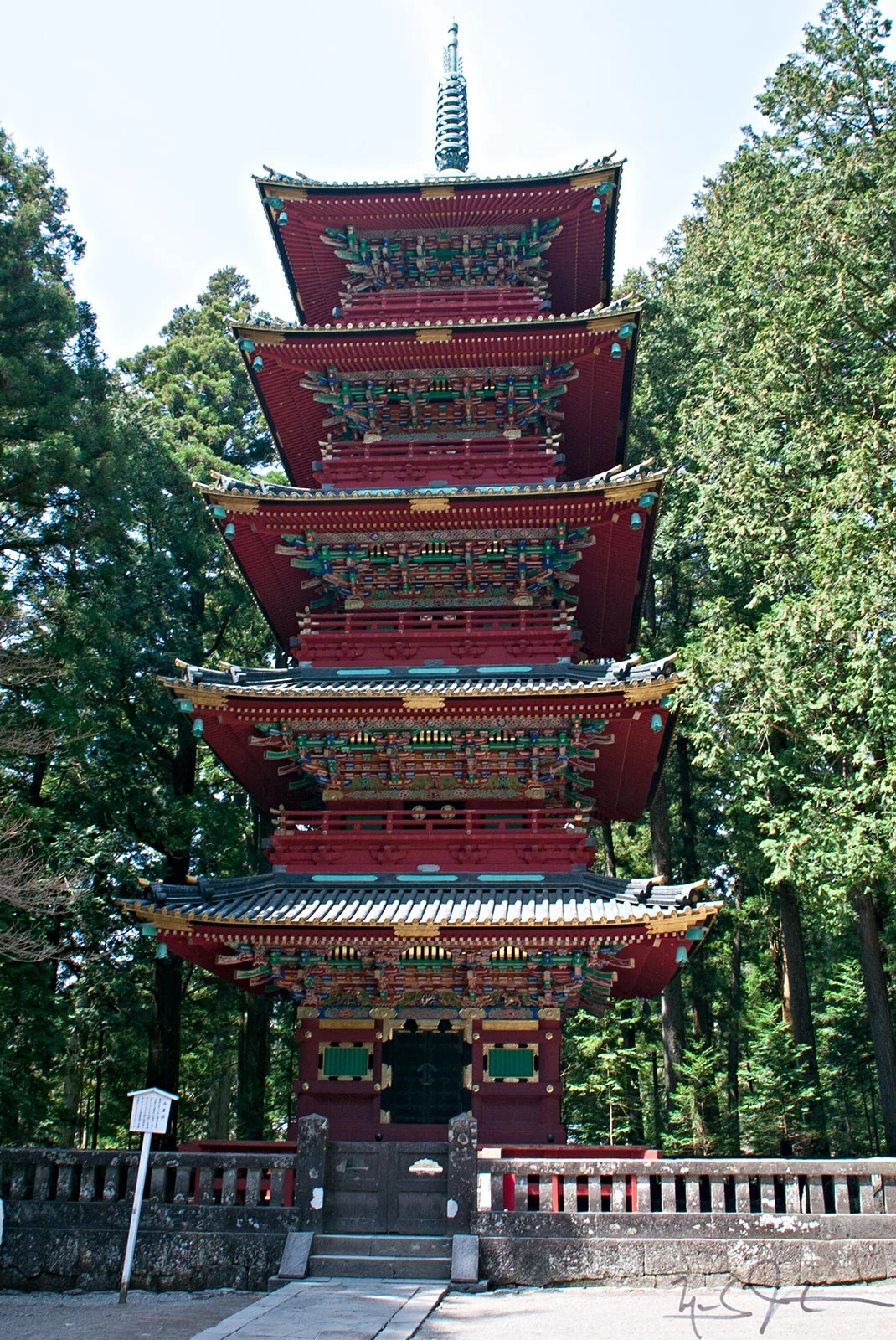
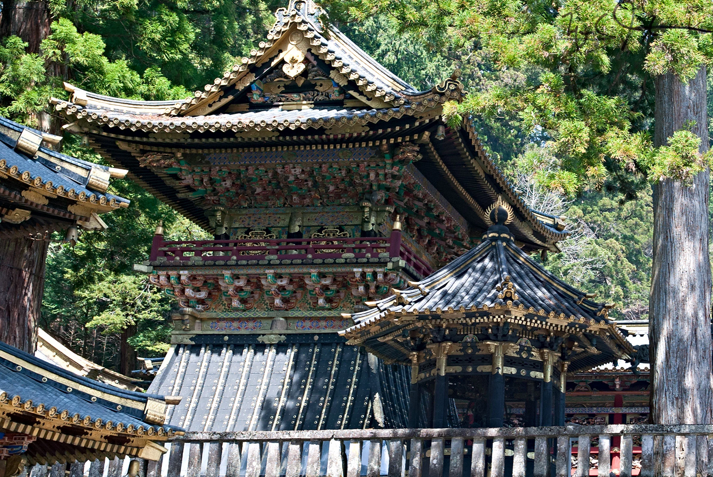
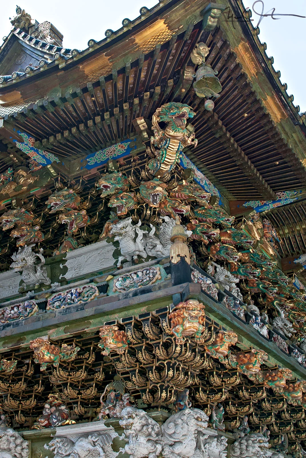
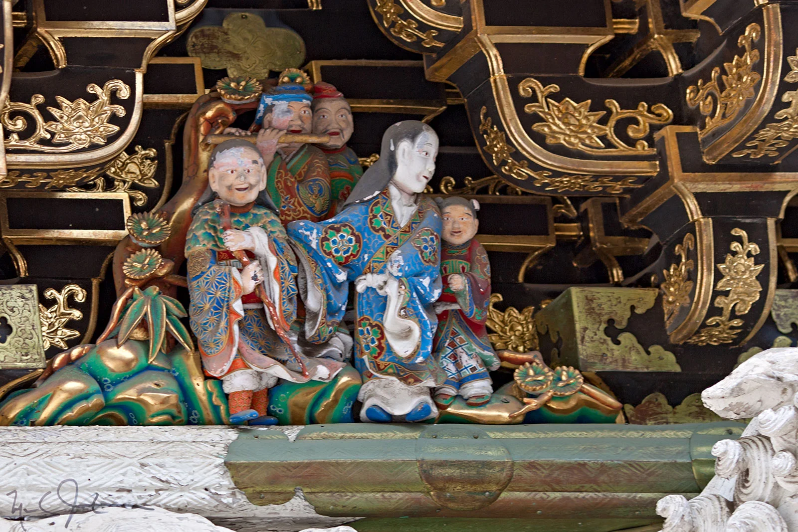
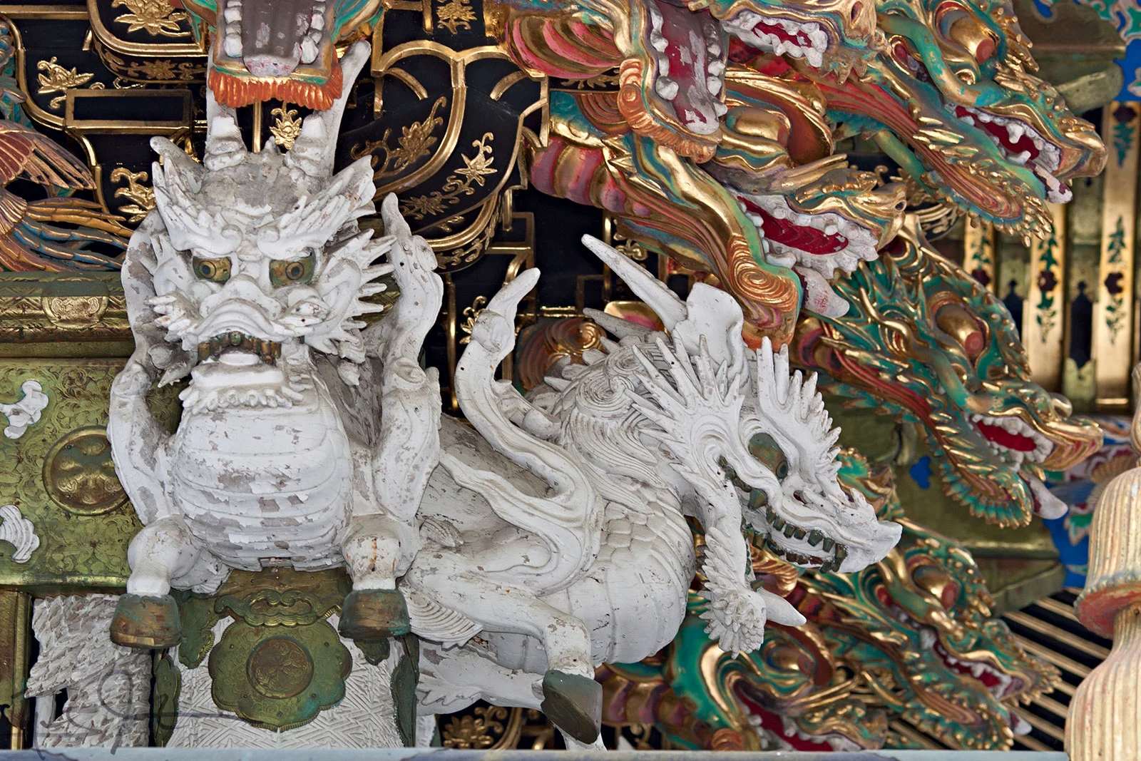
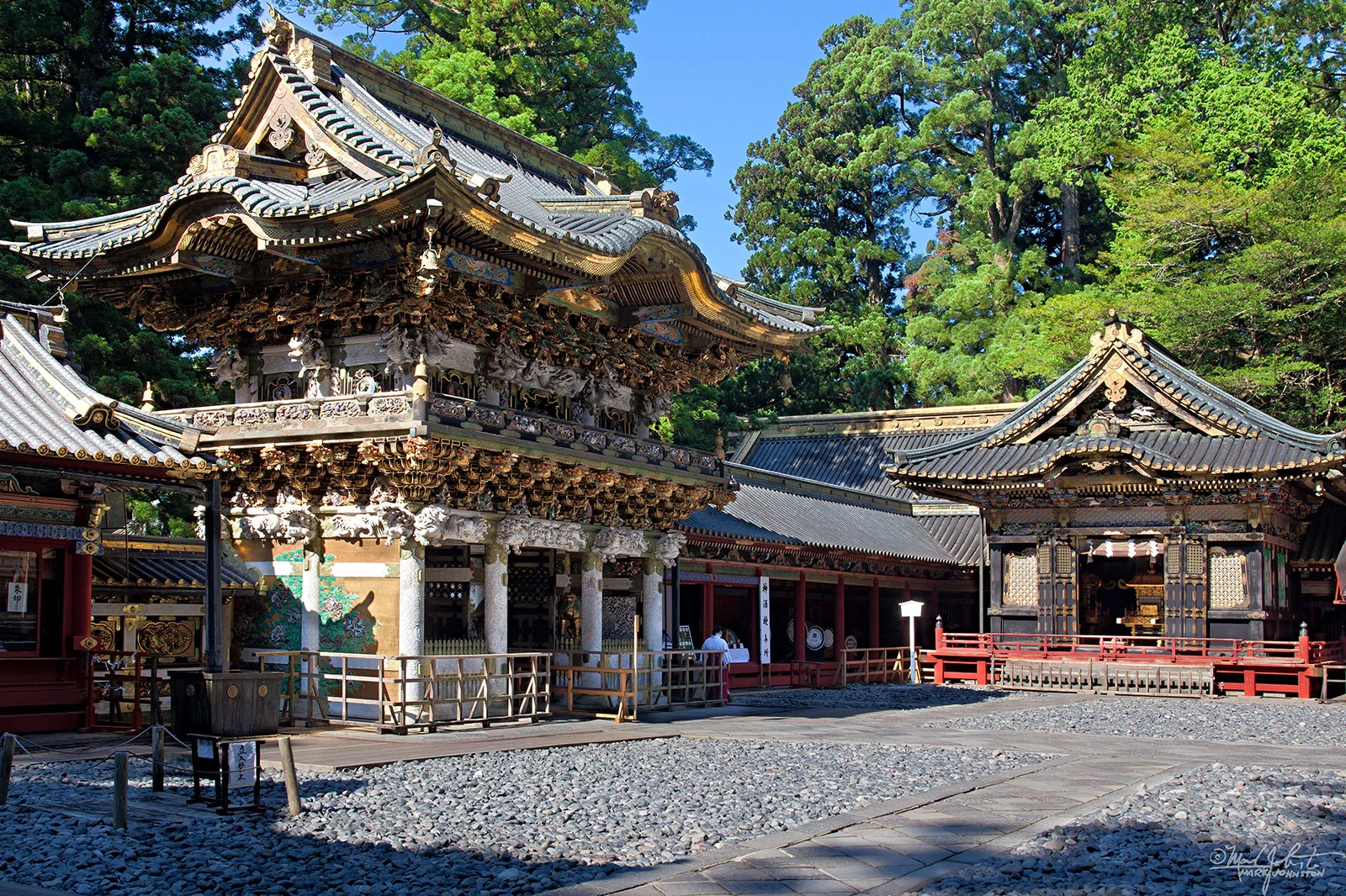
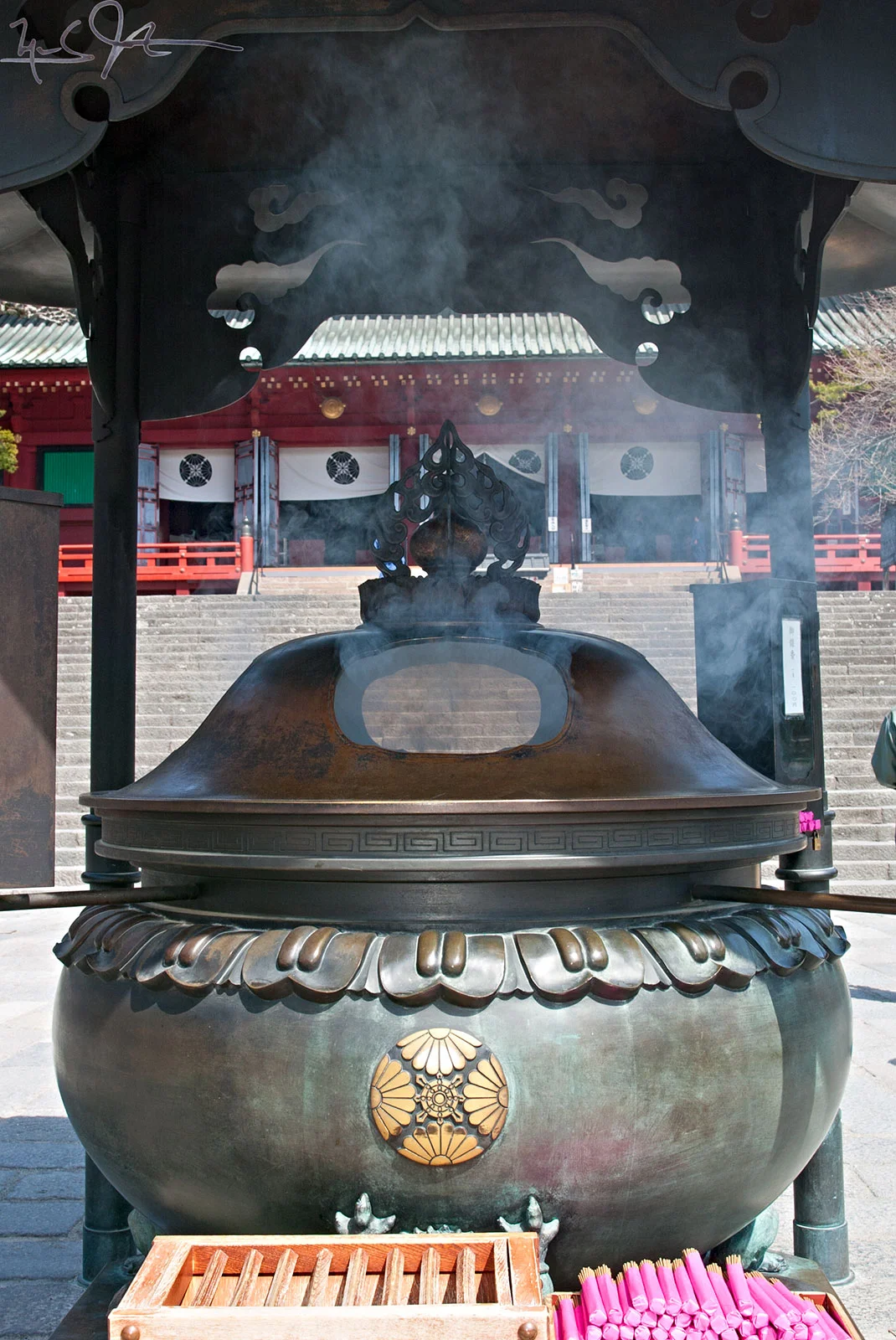
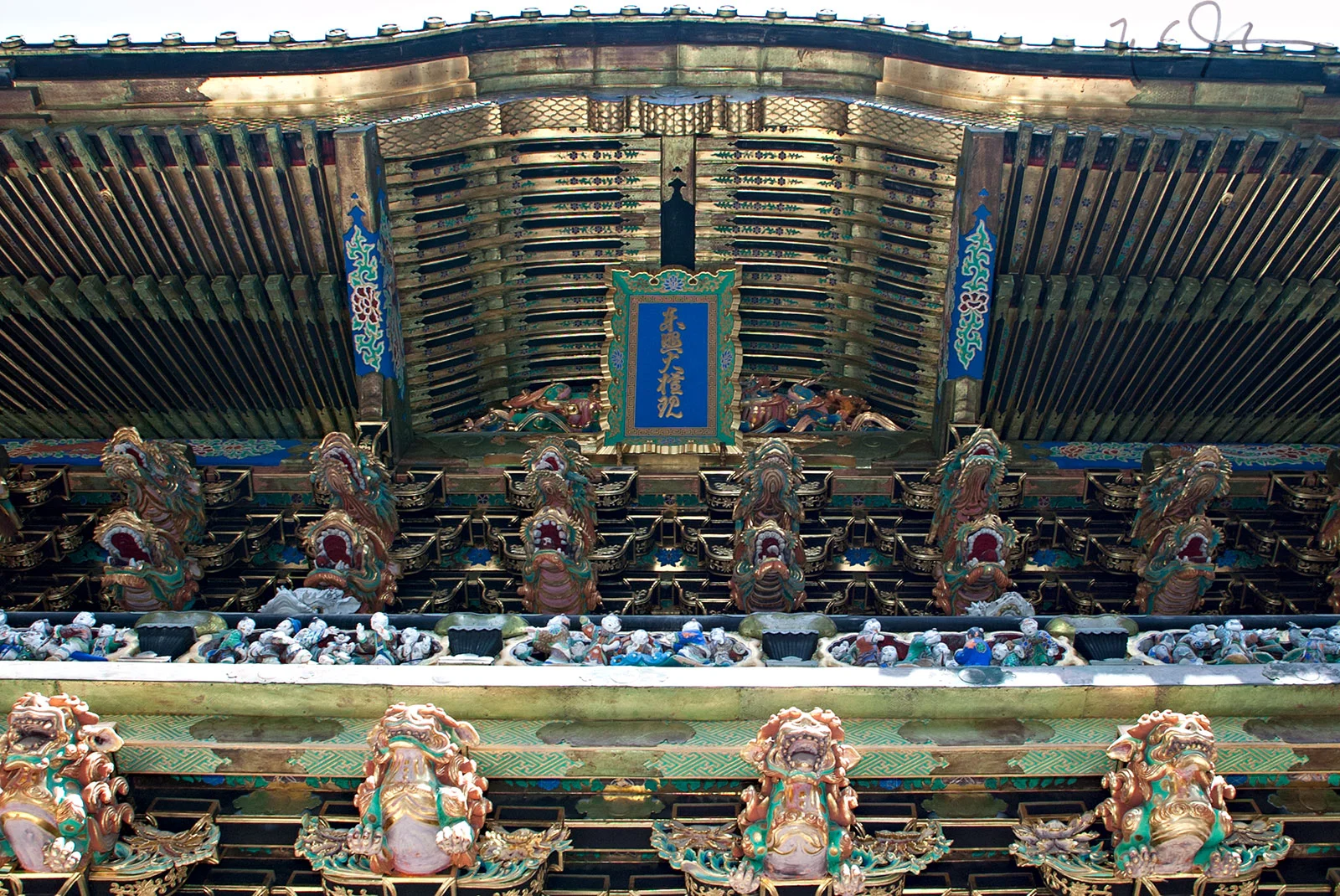
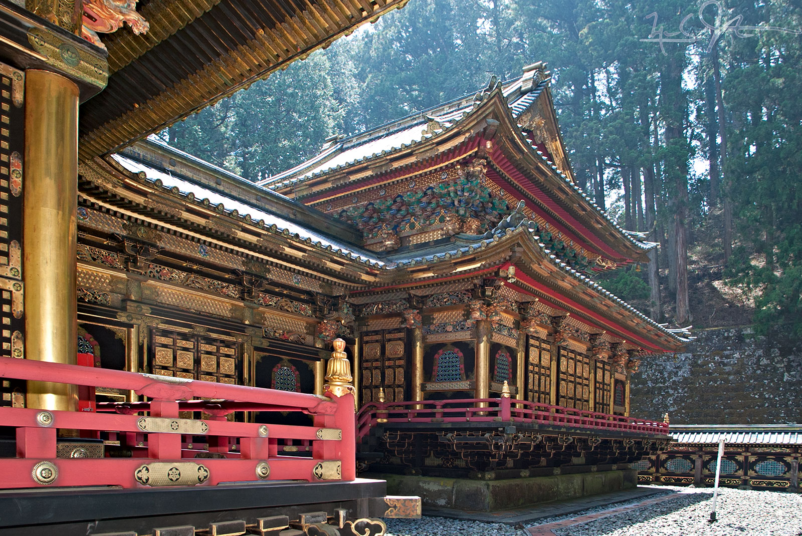
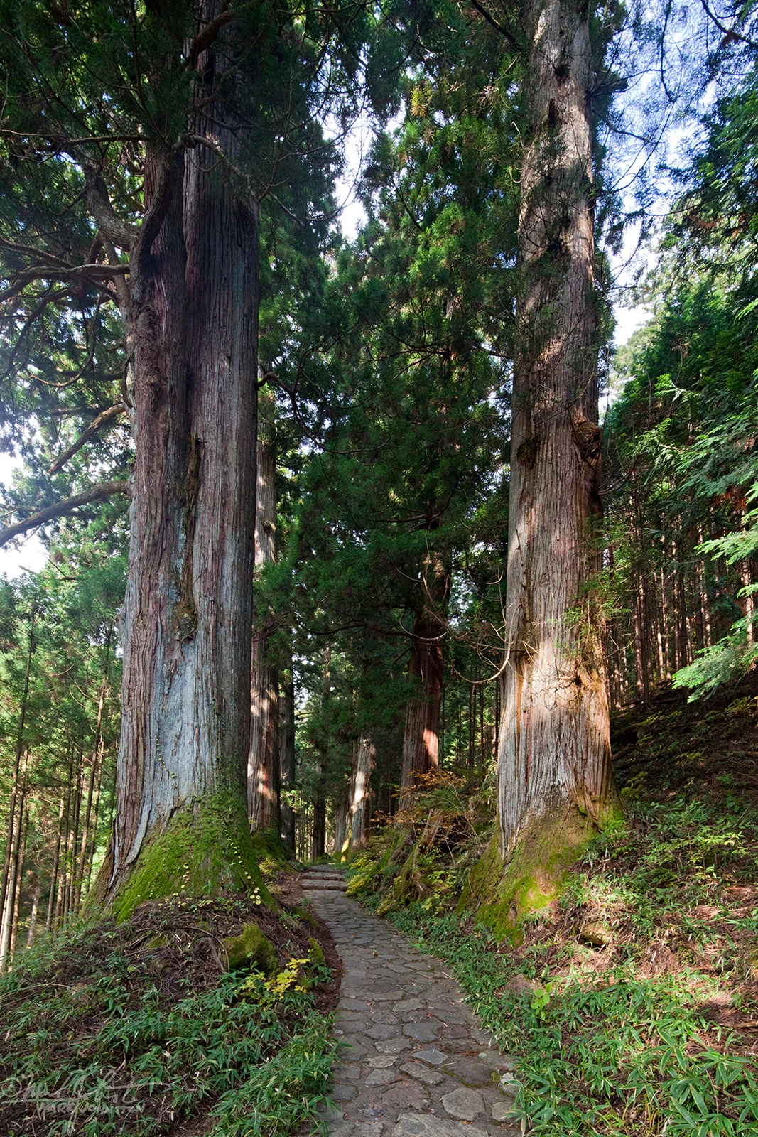
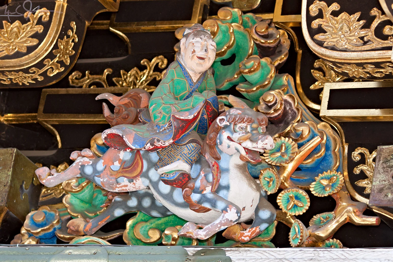
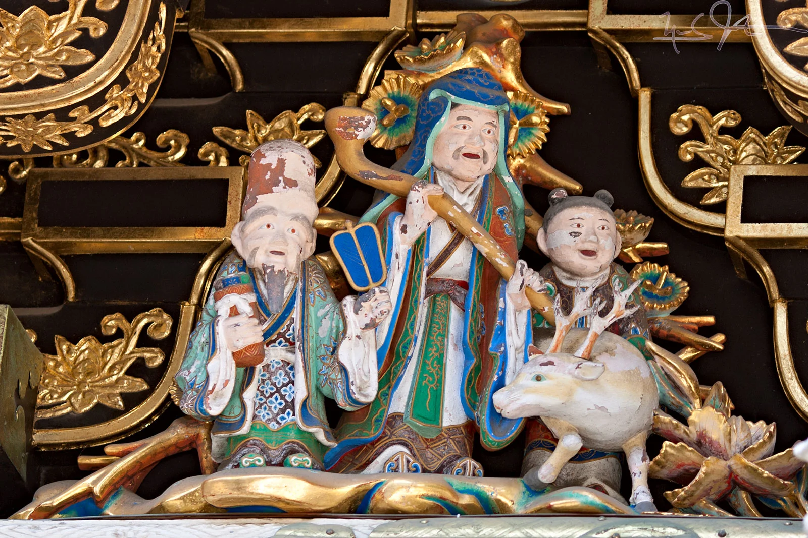
​Nikko, in Tochigi Prefecture an hour or so by train north of Tokyo, is the location of Toshogu - the temple that enshrines the first Tokugawa Shogun, Ieyasu, the warlord who unified Japan in the last years of the 16th century.

0422-_g5z-0953.jpg
0419-_r3z-0160.jpg
0419-_r3z-0164.jpg
1031-5D-6758-6760.jpg
1031-5D-7344-7348.jpg
1031-5D-6707-6909.jpg
1044-5D-0633-0635.jpg
0422-_g5z-0957.jpg
0316-_112C-1335.jpg
0422-_g5z-0960-0962.jpg
1031-5D-7449-7451.jpg
0419-_r3z-0171.jpg
0316-_112C-1348.jpg
0316-_112C-1342.jpg
0316-_112C-1376.jpg
0424-_112C-2230-2233.jpg
0316-_112C-1374.jpg
0419-_r3z-0180.jpg
0419-_r3z-0181.jpg
0419-_r3z-0185.jpg
0419-_r3z-0198-0199.jpg
0419-_r3z-0200.jpg
0419-_r3z-0215.jpg
0316-_112C-1369.jpg
0419-_r3z-0202.jpg
0419-_r3z-0204.jpg
1031-5D-7544.jpg
0419-_r3z-0213.jpg
1031-5D-7518.jpg
0316-_112C-1366.jpg
0422-_g5z-0984.jpg
0316-_112C-1365.jpg
0419-_r3z-0209.jpg
1031-5D-7520.jpg
1031-5D-7527.jpg
0419-_r3z-0220.jpg
0316-_112C-1371.jpg
0419-_r3z-0222.jpg
1031-5D-7502-7503.jpg
1031-5D-7521-7523.jpg
1031-5D-7482.jpg
0316-_112C-1327.jpg
0316-_112C-1370.jpg
0424-_112C-2222-2228.jpg
1031-5D-7483.jpg
0316-_112C-1368.jpg
0316-_112C-1345.jpg
0316-_112C-1363.jpg
0316-_112C-1375.jpg
0316-_112C-1352.jpg
0316-_112C-1426.jpg
0316-_112C-1393.jpg
0316-_112C-1433.jpg
0424-_112C-2290.jpg
0316-_112C-1392.jpg
0316-_112C-1325.jpg
0316-_112C-1403.jpg
0316-_112C-1412.jpg
0316-_112C-1430.jpg
0316-_112C-1324.jpg
0316-_112C-1321.jpg
1031-5D-6832.jpg
0316-_112C-1399.jpg
1031-5D-6916.jpg
1031-5D-6942-6944.jpg
1031-5D-6977.jpg
1031-5D-7047.jpg
0419-_r3z-0250.jpg
1031-5D-7075.jpg
1031-5D-7024-7026.jpg
1031-5D-7057.jpg
1031-5D-7060.jpg
1031-5D-7084.jpg
1031-5D-7103.jpg
1031-5D-7186.jpg
1031-5D-7207.jpg
1031-5D-7209.jpg
1031-5D-7211.jpg
1031-5D-7226.jpg
1031-5D-7393.jpg
1031-5D-7395.jpg
0316-_112C-1428.jpg
0424-_112C-2333.jpg
1031-5D-7386-7387.jpg
1044-5D-0678-0680.jpg
1044-5D-0684-0685.jpg
1044-5D-0738.jpg
1044-5D-0762-0763.jpg
1044-5D-0948.jpg
1044-5D-0985.jpg
1044-5D-1015,1017.jpg
1044-5D-1045,1046.jpg
1044-5D-1078-1079.jpg
1044-5D-1126-1128.jpg
1044-5D-1190-1191.jpg
1044-5D-1715.jpg
1044-5D-1720.jpg
1044-5D-1763.jpg
1044-5D-1776.jpg
1044-5D-1778.jpg
1044-5D-1783.jpg
1044-5D-1785.jpg
1044-5D-1786.jpg
0316-_112C-1443.jpg
0422-_g5z-1000.jpg
0422-_g5z-1001.jpg
0422-_g5z-1004.jpg
0422-_g5z-1012.jpg
0422-_g5z-1014.jpg
0422-_g5z-1017.jpg
0422-_g5z-1020.jpg
0422-_g5z-1022.jpg
0422-_g5z-1023.jpg
0422-_g5z-1024.jpg
0422-_g5z-1025.jpg
0422-_g5z-1028.jpg
0422-_g5z-1032.jpg

Amagi - Kawazu

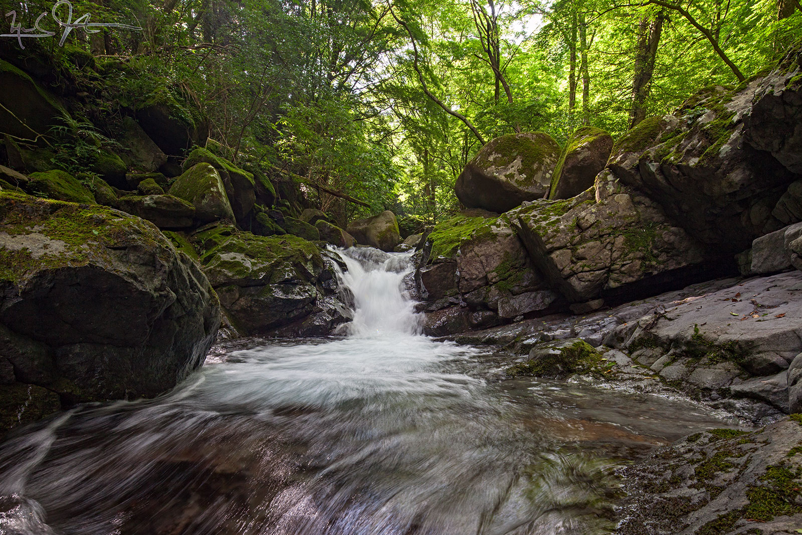
​Up on the mountainous backbone of the Izu Peninsula, above the town of Kawazu, Japanese horseradish, wasabi, grows in the clear, cold water that flows down through the forests.

And the old Amagi Road that runs between Shuzenji and Kawazu, made famous in one of Japan's best-known short stories, "The Dancing Girl of Izu", descends through little villages and farms.​

1026-5D-5455.jpg
1026-5D-5505.jpg
1026-5D-5322.jpg
1026-5D-5349.jpg
1026-5D-5353.jpg
1026-5D-5370.jpg
1026-5D-5425-5427.jpg
1026-5D-5499.jpg
1026-5D-5609.jpg
1026-5D-5623.jpg
1026-5D-5662-5670.jpg
1026-5D-5676.jpg
1122-5D-0788.jpg
1122-5D-0798.jpg
1122-5D-0814.jpg
1122-5D-0832.jpg
1122-5D-0906.jpg
1122-5D-0953.jpg
1122-5D-0958.jpg
1122-5D-0962.jpg
1122-5D-1040.jpg
1122-5D-1053.jpg
1122-5D-1059.jpg
1023-5D-5209-5210.jpg

Bryce Canyon

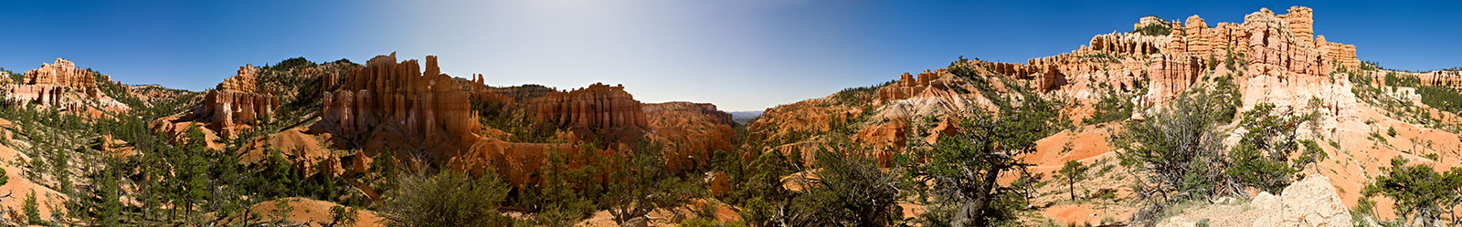
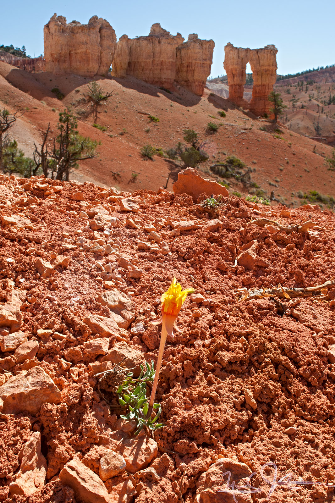
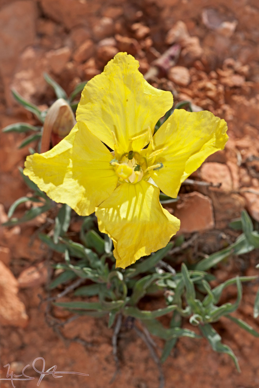
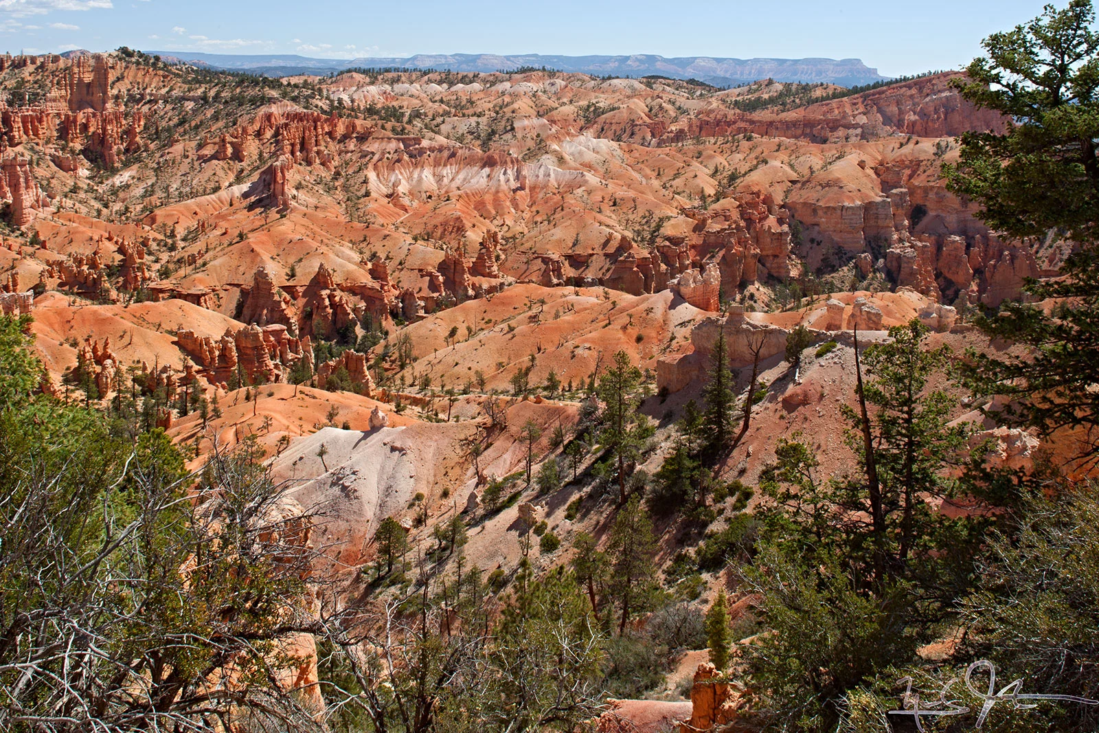
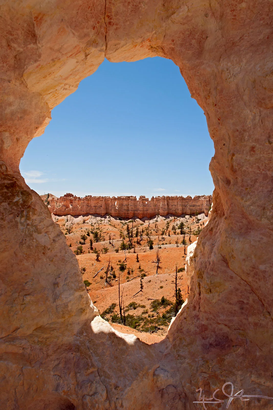
​Bryce Canyon is a unique geologic formation in southwestern Utah.

Bryce is distinctive due to geological structures called "hoodoos", columns of rock formed by the action of freeze/thaw cycles and erosion on sedimentary rock layers of varying hardness and solubility.

0724-_r3z1483-1487.jpg
0724-_r3z1540-1542.jpg
0724-_r3z1617-1632.jpg
0724-_r3z1660.jpg
0724-_r3z1679.jpg
0724-_r3z1686.jpg
0724-_r3z1703-1708.jpg
0724-_r3z1734.jpg
0724-_r3z1815-1816.jpg
0724-_r3z1828.jpg
0724-_r3z1489.jpg
0724-_r3z1505.jpg
0724-_r3z1508.jpg
0724-_r3z1513.jpg
0724-_r3z1515.jpg
0724-_r3z1516.jpg
0724-_r3z1525.jpg
0724-_r3z1551.jpg
0724-_r3z1590.jpg
0724-_r3z1597.jpg
0724-_r3z1638.jpg
0724-_r3z1645.jpg
0724-_r3z1649.jpg
0724-_r3z1672.jpg
0724-_r3z1686.jpg
0724-_r3z1687.jpg
0724-_r3z1693.jpg
0724-_r3z1703-1708.jpg
0724-_r3z1712.jpg
0724-_r3z1732.jpg
0724-_r3z1748.jpg
0724-_r3z1751.jpg
0724-_r3z1765.jpg
0724-_r3z1769.jpg
0724-_r3z1772.jpg
0724-_r3z1773.jpg
0724-_r3z1809.jpg
0724-_r3z1828.jpg
0724-_r3z1829.jpg

Capitol Reef

A stroll above Chimney Rock, along the Mummy Cliffs, and into head of Chimney Rock Canyon.

1221-_P2A-4592.jpg
Chimney Rock
Chimney Rock
Chimney Rock
Chimney Rock
1221-_P2A-4603.jpg
1221-_P2A-4608-4610.jpg
1221-_P2A-4644-4646.jpg
1221-_P2A-4647+4649.jpg
1221-_P2A-4736.jpg
1221-_P2A-4774-4776.jpg
1221-_P2A-4783.jpg
1221-_P2A-4813.jpg
1221-_P2A-4842.jpg
1221-_P2A-4822+4824.jpg
1221-_P2A-4829.jpg
1221-_P2A-4833.jpg
prev / next
Back to Photo Galleries
Transient
20
Devil's Garden, Arches National Park
1115-5D-9630.jpg
35
Izu Oshima
Transient
78
Jyogasaki Coast
Transient
0
Mt. Meeker & Long's Peak Videos
Transient
0
National Championship Air Races
Transient
0
Nature Photography
Transient
117
Nikko
Transient
0
Panoramas
Transient
24
Amagi - Kawazu
0724-_r3z1483-1487.jpg
39
Bryce Canyon
1221-_P2A-4813.jpg
15
Capitol Reef