Panoramas

I added a section to this site that contains some of the panoramas I have shot, mostly multiple images stitched together, but a few single frames that just have a panoramic view.​  There's a pretty even mix between urban views - Tokyo, Shanghai, Hong Kong and more - and more natural landscapes - The Rockies, Mt. Fuji, temples, train stations, etc.

Tokyo, from the Shibuy​​a district.​

Tokyo, from the Shibuya district.​

Just click on either of the images or captions above to be taken to the full collection.

Milner Pass towards Mount Ida

A hike along the Continental Divide. 

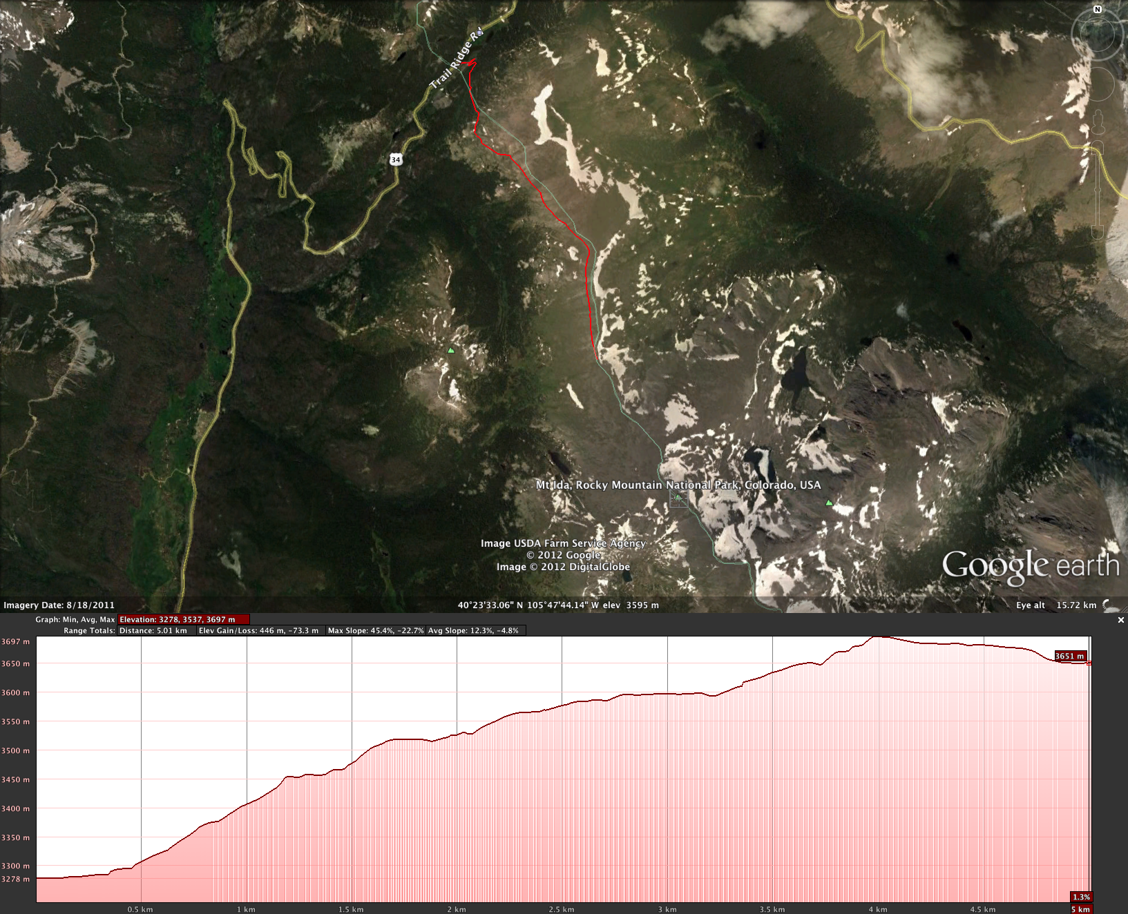
This route starts at Milner Pass on the Continental Divide.  It climbs from about 10,500 ft. MSL to well above the tree line, towards the summit of Mt. Ida, at 12,280 ft. 

Starting point - Poudre Lake at dawn.​

Starting point - Poudre Lake at dawn.​

The route.​

The route.​

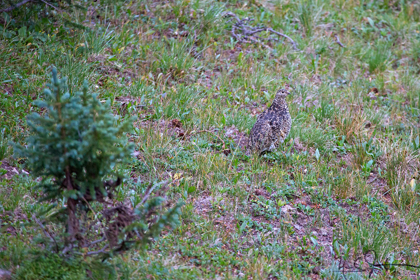
Ptarmigan in summer colors.​

Ptarmigan in summer colors.​

Elk graze at dawn."Nice rack!"​​"Thanks - you, too."

Elk graze at dawn.

"Nice rack!"​

​"Thanks - you, too."

Yellow-Bellied Marmot.​

Yellow-Bellied Marmot.​

Front porch with a view.​

Front porch with a view.​

​Many paths in addition to the human trail.

​Chipmunks at play.

​Chipmunks at play.

​
​"Small Apollo" butterfly.

​"Small Apollo" butterfly.

Looking from the Continental Divide over a few unnamed lakes towards Forest Canyon, with Trail Ridge and Trail Ridge Road in the distance.​

Looking from the Continental Divide over a few unnamed lakes towards Forest Canyon, with Trail Ridge and Trail Ridge Road in the distance.​

​Rocky Mountain panorama.

​Rocky Mountain panorama.

A rock rabbit, or Pica.​

A rock rabbit, or Pica.​

​
​
​
​Storing up for the winter?

​Storing up for the winter?

Mule deer.​

Mule deer.​

A mushroom bursts forth.​

A mushroom bursts forth.​

Many mushrooms burst forth.​

Many mushrooms burst forth.​

​
​

The Martian Triangle

Saturn [at the apex], Spica [lower left], and Mars [lower right] form a nice equilateral triangle in the sky just after sunset.

Spica, 260 light years from Earth, is mis-classified as a "blue giant" - but it is actually a pair of stars so close together that they cannot be resolved through a telescope.

The primary star has more than 10 times the mass of the sun and 7 times its radius. It rotates rapidly, and varies in brightness over about a four-hour period due to expansion and contraction of its surface.  The secondary member of the Spica system is smaller than the primary, with about 7 times the mass of the Sun and 3.6 times the Sun's radius.  Seen as a single star, Spica is brightest star in the constellation Virgo and the 15th brightest star in the nighttime sky.​

Saturn, the star Spica, and Mars form a nice triangle in the sky left of center, just after sundown.​  [Might be difficult to see in this image due to image size and monitor resolution.]

Saturn, the star Spica, and Mars form a nice triangle in the sky left of center, just after sundown.​  [Might be difficult to see in this image due to image size and monitor resolution.]

Close-up of the Martian Triangle.​

Close-up of the Martian Triangle.​

Two views of the Gooseneck/Dead Horse Point

The Gooseneck is a sharp bend in the Colorado River about 13 miles west southwest of Moab, Utah.  At Dead Horse Point State Park, there is a fine view of the surrounding terrain from the mesa above, and closer views of the Gooseneck are afforded from the White Rim Road and Schafer Road down in the ​canyons carved by the River.

Dead Horse Point and the Gooseneck from the northeast, at the overlook at Dead Horse Point State Park.  The point of view of the image below is indicated by the blue arrow.​

Dead Horse Point and the Gooseneck from the northeast, at the overlook at Dead Horse Point State Park.  The point of view of the image below is indicated by the blue arrow.​

From the northwest side of the Gooseneck, down on the White Rim Trail.​  The point of view of the image above is indicated by the blue arrow.​

From the northwest side of the Gooseneck, down on the White Rim Trail.​  The point of view of the image above is indicated by the blue arrow.​

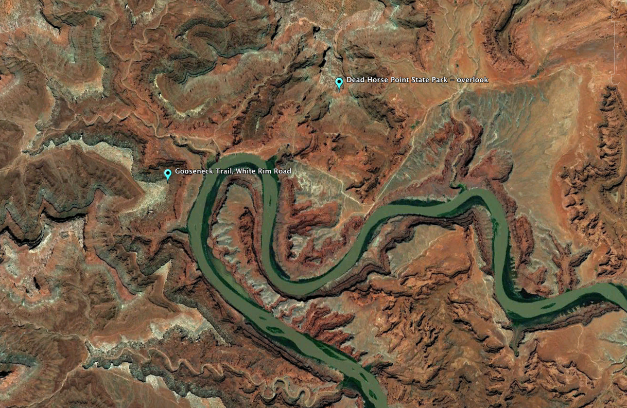
From 37,000 feet, the relative positions from which the two photos above were taken.​

From 37,000 feet, the relative positions from which the two photos above were taken.​